Project case study

GeoRisk — Geospatial ML for natural hazard risk

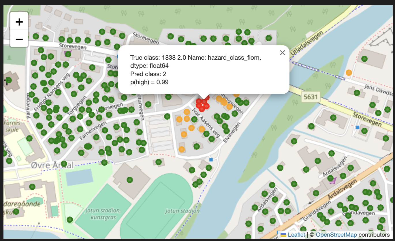
An end-to-end geospatial machine learning project for predictive risk mapping of flood and landslide exposure, using terrain, hydrology, land cover, and property/area-level data.

Problem

Natural hazard risk depends on location-specific factors such as terrain shape, slope, hydrology, land cover, proximity to rivers, and known hazard exposure. The goal was to explore how geospatial data and machine learning can support more consistent risk scoring at property or area level.

Why it matters

Risk-related AI systems are useful only when their outputs are explainable, evaluated, and understandable to people making decisions. This project focuses on applied ML as decision support, not as a black-box prediction exercise.

Project flow

A simplified view of how the project moves from data and domain logic to usable outputs.

1. Define area of interest — choose regions/properties for analysis
2. Load and clean GIS layers — terrain, hydrology, land cover, buildings, hazard data
3. Align spatial data — coordinate systems, geometry cleaning, joins, and filtering
4. Feature engineering — distance features, terrain statistics, hydrological context, hazard proximity
5. Model training and evaluation — baseline ML models and performance checks
6. Export outputs — risk scores, map-ready layers, and evaluation summaries

Data used

  • Terrain / elevation data
  • Hydrology and river proximity
  • Land cover and area context
  • Building/property-level geodata
  • Hazard-related layers

Techniques

  • Spatial preprocessing
  • Raster/vector feature engineering
  • Distance and buffer features
  • Model-ready feature tables
  • ML model evaluation

What it demonstrates

  • Applied ML on messy real-world data
  • Geospatial data handling
  • Risk and uncertainty awareness
  • Explainable decision-support thinking
  • End-to-end pipeline structure

What I learned

This project strengthened how I think about practical ML systems: the model is only one part of the work. Data quality, spatial assumptions, evaluation, uncertainty, and communication matter just as much.

Next steps

Useful improvements would include stronger uncertainty estimation, model calibration, automated tests, confidence thresholds, API access to risk scores, map-based explanations, and validation across more regions.